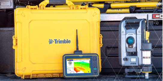
Connect and equip the office, site and vehicles with accurate positioning, consistent digital design information and the ability to locate, measure and record information.
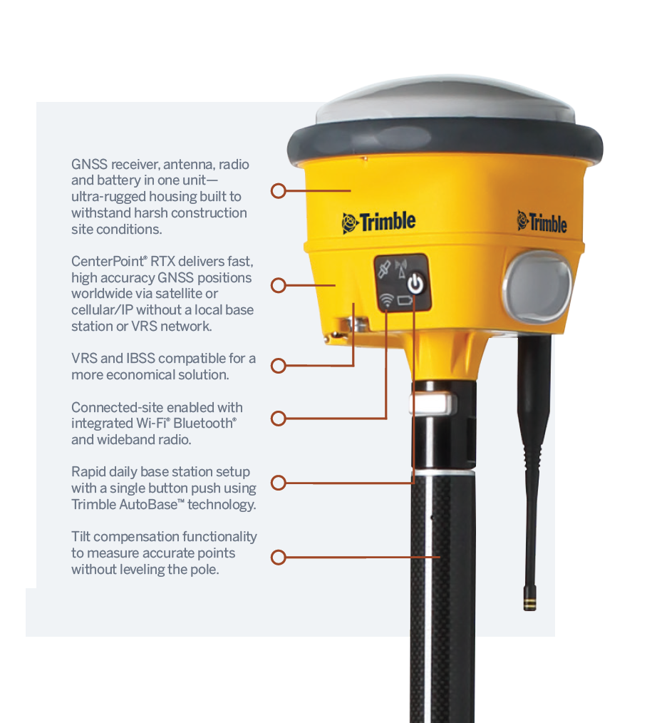
Trimble GNSS for Site positioning can be used as a rover for site measurement and setting out, or as a base station for site measurement and machine control operations. Because the GNSS receiver, GNSS antenna, radio, radio antenna and battery are integrated into one housing, you don’t have to deal with cables and multiple components.
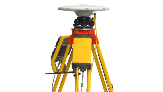
The ultra-rugged Trimble® R780 GNSS Smart Antenna offers unmatched reliability for construction site positioning. Ideal for use on small and large job sites, the R780 can serve as a GNSS rover system or as a base station for other GNSS operations including machine control.
The R780 is scalable from entry-level to high precision applications to fit your needs. It has a longer battery life and incorporates the latest technology to make construction surveying easier, safer and more productive.
Rugged, all-in-one solution
Trimble ProPoint Technology
Trimble ProPoint™ GNSS technology uses all available signals to provide survey-grade positioning in challenging environments where other GNSS systems either can’t provide a solution at all or produce unreliable error estimates..
Trimble xFill Technology
Trimble xFill® technology seamlessly fills in for gaps in RTK or VRS connection streams if the connection is lost, expanding site productivity by allowing short excursions into locations where GNSS corrections were not previously available.
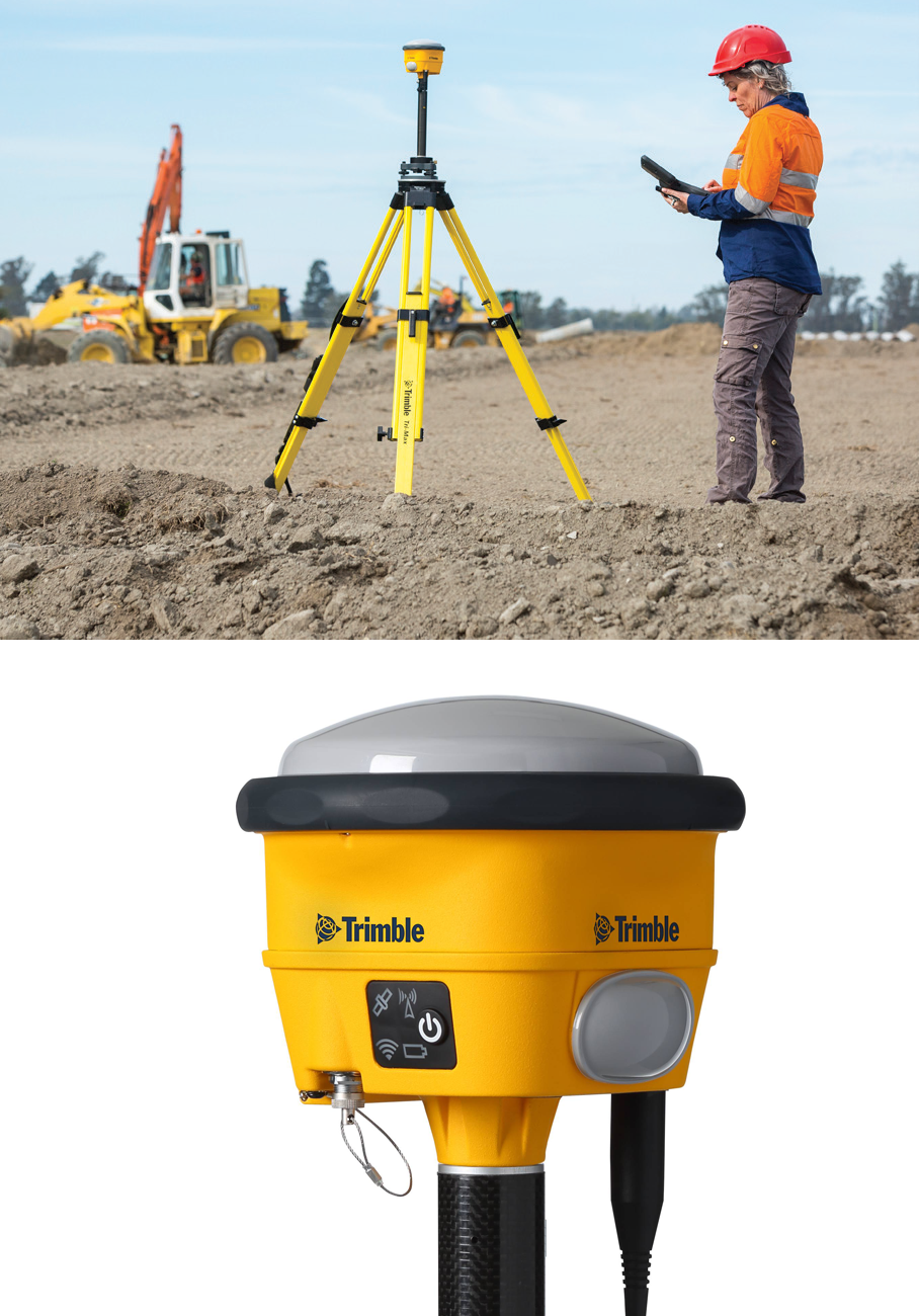
Using the R780 and Trimble Siteworks Software it is now possible to capture accurate points while standing, walking or driving the site in a vehicle, while the receiver is not level.
Full GNSS tilt compensation makes Siteworks easier to learn for beginners and saves significant time for more experienced surveyors. Tilt compensation in vehicle mode is designed to capture higher accuracy measurements on steeper slopes from a moving vehicle, and more accurate volume measurements to save time and money on material planning.
Mount the R780 to a vehicle and do site topos, road centerlines, and check as-builts in even the roughest site conditions. The R780 can withstand high vibration scenarios without interruption or fear of damage.
It has never been so easy to survey. Initial site work and topos can even be done base station-free using satellite-delivered GNSS corrections to the rover..
APPLICATIONS
With the R780 and Siteworks, you can:
Using your smartphone, quickly check the health and status of the receiver with the Trimble GNSS Status App. For a more in-depth look, the Trimble Web UI can be accessed over Wi-Fi. Setting a new standard for rugged reliability, the R780 keeps your crews working, not wasting time with GNSS maintenance.
DOWNLOAD:
Datasheet
Spec Sheet
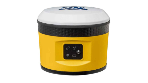
The lightweight and compact Trimble® SPS785 GNSS Smart Antenna is an entry-level, fully capable GNSS receiver, that is ideal for construction surveyors, earthworks supervisors or foremen.
The SPS785 enables users to quickly check site levels, navigate to points, easily execute simple positioning tasks and record features with attributes, pictures and volumes. It is ideal for use on small and large job sites and can serve as a precise GNSS rover or as a base station for other GNSS operations including machine control.
Utilising the unique all-signals tracking and processing Z-Blade GNSS-centric technology the SPS785 provides reliable measurements and high accuracy.
USERS OF THE SPS785 BENEFIT FROM:
APPLICATIONS
Smaller construction sites or combined with GNSS on larger sites.
Tasks where the accuracy requirements are tight.
Measuring dangerous or inaccessible locations.
Automated target measurement for movement of ground or buildings that could be affected by construction activities.
DOWNLOAD:
Datasheet
Spec Sheet

The Trimble® SPS855 GNSS Modular Receiver gives you the flexibility to perform all your construction site measurements. Trimble SPS855 Modular GNSS Receiver is a fully upgradable receiver that can be configured in a variety of ways. Simply purchase the receiver that you need today and upgrade as your needs change.
As a permanent or semi-permanent base station, it provides GNSS corrections for site measurements and machine control. As a rover it can move easily from a site supervisor truck to a pole mount for grade checking, site measurement and set out
THE ADVANTAGES OF USING THE SPS855 ARE:
Highly flexible base or rover – for construction site measurement.
Integrated radio option – for base and rover tasks.
Rapid daily base station setup – with a single button push.
Internet enabled base station – via ethernet or SNM940 Connected Site® Gateway.
Integrated battery – that also acts as a UPS power supply.
CONFIGURATIONS
Base station only
Rover only with SBAS, Location, or Precision Real-Time Kinematic (RTK) accuracy
Flexible base or rover with Precision RTK accuracy
DOWNLOAD:
Datasheet
Spec Sheet
The Trimble® SPS585 Smart Antenna is the ideal entry-level receiver for civil construction applications providing the flexibility to meet many construction site requirements. Ideal for site supervisors, engineers and inspectors, the SPS585’s cable-free operation means it can be easily mounted on a vehicle or survey pole.
The SPS585 is fully configured out of the box and requires no activation or base station setup. Full GNSS dual frequency tracking and positioning comes as standard along with Trimble’s xFill service.
THE SPS585 IS DESIGNED TO:
APPLICATIONS
DOWNLOAD:
Datasheet